IMSI is working with the Ontario Maple Syrup Producers' Association (OMSPA) to explore how LiDAR technology can help us better understand maple forests and their role in carbon storage, using LiDAR data provided by the Ontario Woodlot Association (OWA).
LiDAR (Light Detection and Ranging) uses aerial laser scanning to create detailed maps of forest structure, including tree heights, density and the distribution of tree sizes. This information can help researchers estimate forest biomass and the carbon stored in trees.
At the Environmental Resilience Committee's October 6 meeting, the group was presented with an update on the Lanark District pilot project in Ontario. The project is exploring how LiDAR data, combined with information from maple producers, can help estimate the carbon footprint of participating maple operations.
The pilot is an important step toward developing a more complete picture of maple production, bringing together information about the forests themselves and the activities involved in producing maple syrup.
The work is still evolving.
The findings will help identify both the potential and the limitations of using this technology across the maple industry.
To learn more about IMSI's environmental survey and LiDAR work, explore the project on our
Forest Stewardship page
.
For IMSI members:
The October 6 presentation, summary report and meeting recording are available in the
Environmental Resilience Committee Resources
section of the Member Portal.
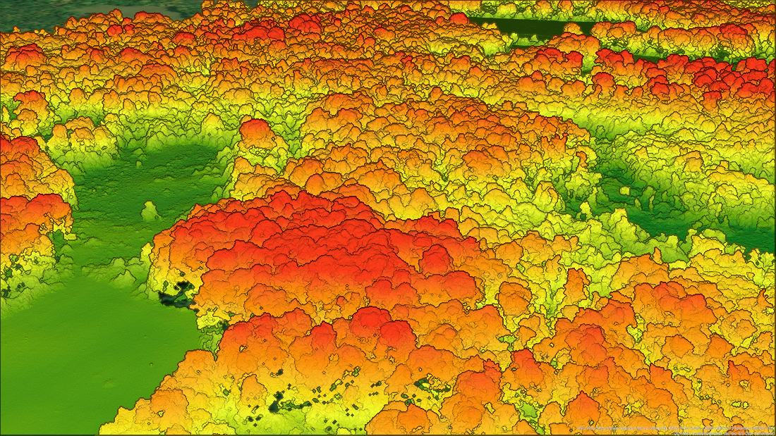
Photo: Ontario Woodlot Association. A three-dimensional LiDAR point cloud of a sugar maple stand. Colours represent height above ground (green to red).